Remember the frustration of deciphering cryptic Indian addresses, relying on “next to the chai shop” as your only guide?
Google Maps is stepping up its game to navigate these complexities, bringing the familiarity of real-life landmarks to its digital streets.
Google Maps also announced partnerships with ONDC and mobility app Namma Yatri to provide a more digitised public transport experience to users.
Google India
Unraveling the Mystery of Indian Addresses
Table of Contents
- Unraveling the Mystery of Indian Addresses
- Visual Cues to Conquer Unfamiliar Streets
- Walking with Ease: Live View Takes the Lead
- More Than Maps: Embracing a Digitized India
- Sustainability on Wheels: Fuel-Efficient Routes Arrive
- Beyond Mumbai and Delhi: Expanding Local Train Coverage
- The Future of Google Maps in India
Gone are the days of squinting at maps, struggling to make sense of unstandardized street names. Google Maps is rolling out Address descriptors, an India-first feature powered by AI. This smart tool automatically identifies up to five relevant landmarks or area names around any pinned location. Imagine searching for “that temple near the market,” and voila, Google Maps points you right there! This feature, launching early next year, will be a boon for both locals and visitors, making exploring India’s vibrant streets a breeze.

Visual Cues to Conquer Unfamiliar Streets
Ever wished you could understand your surroundings just by looking around?
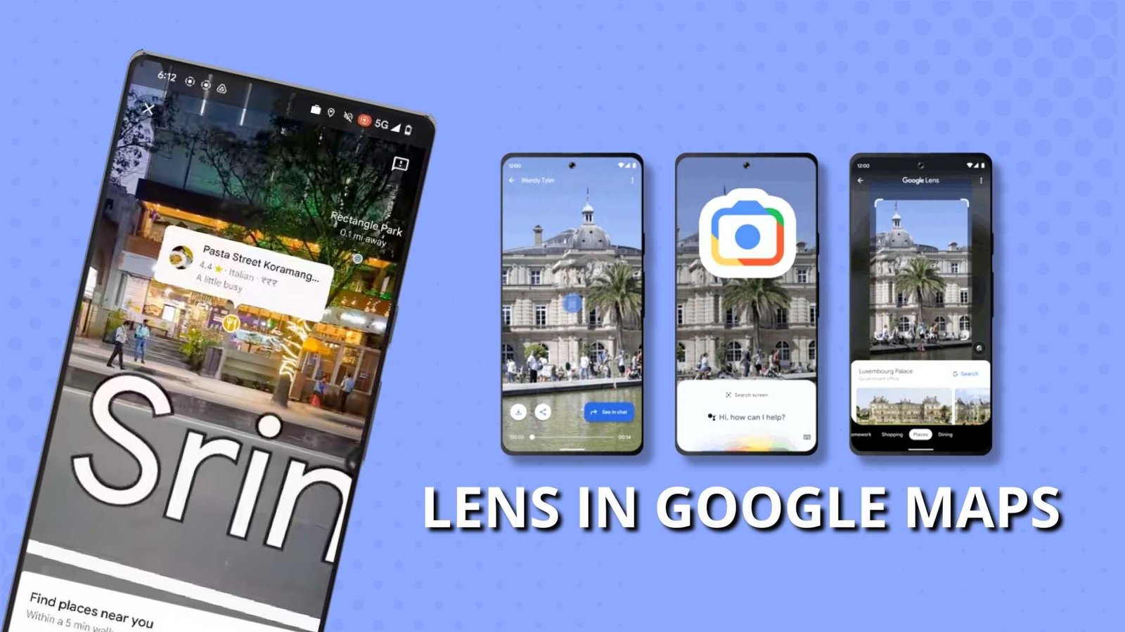
Google is making it possible with the Lens in Maps feature. Launching in 15 Indian cities next January, Lens lets you point your camera at any street scene and instantly see nearby restaurants, cafes, and other points of interest. Get real-time updates on opening hours, ratings, reviews, and even photos – all through your phone’s lens!
This is like having a local guide in your pocket, ready to answer any “What’s that place?” question.

Walking with Ease: Live View Takes the Lead
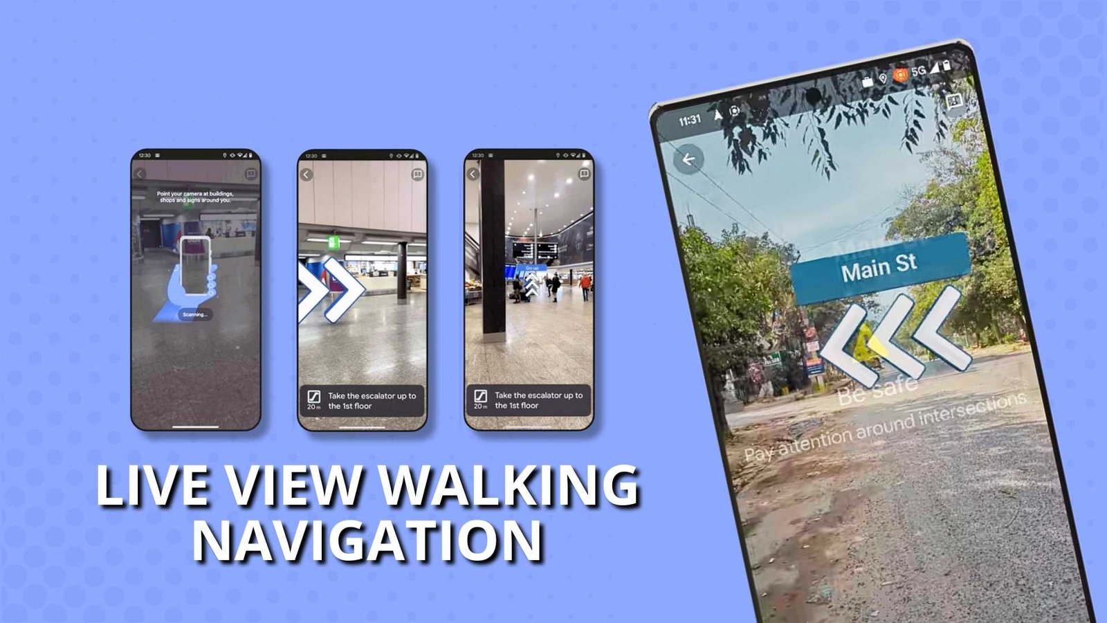
Getting lost while exploring on foot? Live View walking navigation comes to the rescue!
Overlayed on your Maps screen, you’ll see clear arrow marks, directions, and distance markers guiding you every step of the way. Plus, gentle phone vibrations alert you to turns and destinations, making even the most confusing alleys a walk in the park.
This feature, arriving in over 3,000 Indian cities and towns, is a game-changer for anyone who loves to explore on foot.

More Than Maps: Embracing a Digitized India
Google’s commitment to India extends beyond navigation.
Their partnership with Open Network for Digital Commerce (ONDC) and mobility app Namma Yatri brings metro schedules and bookings right onto Google Maps. Starting with Kochi by mid-2024, this collaboration promises a seamless public transport experience, empowering users and paving the way for a more connected, accessible India.

Sustainability on Wheels: Fuel-Efficient Routes Arrive
Concerned about your carbon footprint? Google Maps has your back.
Their fuel-efficient routing feature, already popular for four-wheelers, is expanding to two-wheelers in India and Indonesia by January 2024. This AI-powered tool, claiming to have saved over 2.4 million metric tons of CO2e emissions globally, identifies routes that minimize fuel and emissions, considering real-time traffic, road elevation, and even your vehicle type. Choose the eco-friendly path without sacrificing time, contributing to a greener future for all.
Beyond Mumbai and Delhi: Expanding Local Train Coverage
A large majority of people in India depend on public transport for their daily mobility needs. Over the years, we have partnered with numerous local authorities towards this goal, enabling millions of users to find information about various modes of public transport including metros, trains, and buses in over 20 Indian cities. We’re excited to share new ways we’re doing this across our Google products.
Starting with one of our most-loved products – the Where Is My Train app. Every month, more than 80 million people use the Where Is My Train app to navigate intercity train journeys, enabling people to access dynamic information like schedule changes, delays, and platform numbers, which might not be easily accessible otherwise. Today we are announcing the expansion of Where Is My Train to cover Mumbai and Kolkata Local Trains, with more cities to come.
For city commuters, Google Maps is adding Mumbai and Kolkata local trains to the Where Is My Train app. Get dynamic updates on train location, real-time status, and platform changes, ensuring you never miss a beat on your daily commute.
The Future of Google Maps in India
These innovations showcase Google’s commitment to building a map that transcends mere directions. It’s about understanding the unique complexities of India, catering to diverse needs, and empowering users to experience the country like never before. From navigating bustling streets to embracing a sustainable future, Google Maps is evolving into a truly indispensable India travel companion.

So, pack your bags, open Google Maps, and get ready to experience India in a whole new light!


